
Foildarg [An Fhaille Dearg]
Good walks are even better shared.
Overview
Foildarg [An Fhaille Dearg]
Foildarg, rising to an elevation of 681 meters, is a prominent peak in the enchanting Sperrin Mountains of Northern Ireland. A Marilyn, it captures the hearts of hikers seeking both adventure and tranquillity.
Geology
The geology of Foildarg features a fascinating mix of sandstone and siltstone, painted with nature’s palette over millennia. The occasional outcrop reveals the rugged character of this ancient land, providing geological enthusiasts with ample opportunities to ponder the Earth’s history.
Routes
The most popular route starts from Ballyhullion Road and covers approximately 5.5 km, typically taking about 2.5 hours to ascend at a moderate pace. The walk is genuinely delightful, taking you through lush valleys adorned with vibrant heather—a perfect setting for anyone looking to channel their inner hobbit!
Summit Features
Once at the summit, a modest stone cairn greets you. A photo here is practically a rite of passage for every hiker, and let’s be honest, it helps justify that well-deserved stop for a snack!
Terrain Type
The terrain is primarily grassy with rocky sections, making for manageable walking interspersed with moments that may make you feel like a mountaineer. Keep an eye out for those thrilling scrambles!
Views
The views from Foildarg are nothing shy of spectacular. You’ll find yourself enchanted by the rugged profiles of the Sperrin Mountains themselves, and on particularly clear days, you might even catch a glimpse of the Donegal coastline in the distance.
For optimal viewing pleasure, spring and autumn provide stunning vistas and beautiful colours. Early morning is beaten only by a bonnie sunrise painting the sky.
Hazards
As with any mountain, a few hazards warrant your attention: be mindful of the boggy patches lower down and the loose gravel that may greet your boots on the steeper sections. Weather can fluctuate wildly—bring layers and perhaps a snack—even if just to sweeten your chances of meeting fellow hikers!
Nearby Summits
Foildarg is bordered by significant peaks, including Cairn Mountain at 704 meters and Mullaghaneany at 659 meters, presenting the ultimate excuse for a multi-summit day!
Access
Access is straightforward. The nearest parking can be found along Ballyhullion Road, accommodating several cars but arrive early to beat the rush.
Public transport can get you near, with bus services running from Dungiven; however, a wee taxi ride will take you straight to the trailhead if required. Dungiven offers the closest amenities, ranging from charming cafes to community pubs ready to welcome tired hikers.
Facilities
While no facilities are situated right at the mountain, Dungiven is just a stone’s throw away, boasting all the essentials to help replenish your energy post-hike.
History
The mountain’s name, translating to 'the red cliff,' alludes to the striking geology and historical narratives tied to the landscape. Rich in local folklore, the Sperrin Mountains have long been sacred to the people in the region—a place where legends rest among the heather.
Happy hiking, and may your boots stay dry!
Explore routes near Foildarg [An Fhaille Dearg]
Public walks starting within 80 km of this hill. Nearby does not mean a route reaches the summit; check its map and access before setting out.
No public routes are currently listed within 80 km of Foildarg [An Fhaille Dearg] on Walkmates. This does not mean there are no paths here. Explore the map and check local access information before planning a walk.
Route planning notes
These notes describe possible approaches, not verified navigable routes or permission to cross land. Check current paths, local access rules and conditions before setting out.
Ballyhullion Road Route
A scenic ascent starting from Ballyhullion Road that leads you through lush valleys adorned with heather before making your way up the gentle slopes of Foildarg.
Make a day of it, together
Find someone to share the walk with, or organise a day out along a route you like.
Hill facts and local notes
Classifications
Elevation
440m
1,444 ft
Prominence
212m
Coordinates
52.6115, -8.1557
R895511
OS Map
66
At the Summit
The summit is marked by a small stone cairn, providing a perfect excuse for a quick photo opportunity!
Terrain & Geology
Foildarg comprises predominantly sandstone and siltstone, characteristic of the Sperrins, with some stunning outcrops that reveal the area's geological history.
Views & Scenery
From the summit, you can feast your eyes on the rugged profiles of the Sperrin Mountains, as well as the lush valleys below and, on a clear day, a glimpse of the distant Donegal coastline.
History & Heritage
Name Origin
The name 'Foildarg' translates to 'the red cliff' in Irish, possibly referring to the reddish-tinted rocks found in the area.
Historical Significance
The Sperrin Mountains have a rich heritage steeped in mythology and folklore, often regarded as a sacred landscape in local history.
Getting There & Facilities
Check current local access restrictions, parking rules and transport timetables before travelling. These notes do not confirm public access to the summit.
Parking
There is a small parking area off Ballyhullion Road, accommodating a few cars. It's best to arrive early to secure a spot.
Public Transport
Buses run from Dungiven to the nearest village, but you'll need to arrange a short taxi ride to reach the trailhead from there.
Nearby Facilities
While there are no facilities directly near Foildarg, Dungiven offers cafes, toilets, and accommodation if you wish to extend your stay.
Safety Information
Known Hazards
- Be wary of boggy patches in the lower sections and loose gravel on steeper slopes. Weather can change rapidly; be prepared for all seasons.
General Safety Tips
- Check weather conditions before setting out
- Carry appropriate clothing and equipment
- Let someone know your planned route
- Take a map, compass, and GPS device
- Carry emergency supplies: food, water, first aid kit, torch
Hills
Some common questions about the hills answered
Are there group walks up Foildarg [An Fhaille Dearg]?
Many walkers use Walkmates to join or organise walks with others. You can check for group walks around Foildarg [An Fhaille Dearg] through the maps
Are there other walkers around Foildarg [An Fhaille Dearg]?
Activity varies by location and time, but Walkmates lets you see whether others have shared walks or shown interest in this area. Find other people through the walking friends search walking friends for Foildarg [An Fhaille Dearg] search or of course create your own walk for Foildarg [An Fhaille Dearg]
Can I organise a walk to Foildarg [An Fhaille Dearg]?
Yes. If there aren’t any walks listed already, you can create a walk and make it available for others to join.
If you're signed up to Walkmates, you can create a walk to Foildarg [An Fhaille Dearg].
How do I find a walk up this hill?
There are often multiple ways to walk this hill, depending on experience and route preference. Walkmates helps you explore walks and routes that others have shared.
Can I suggest a new route up Foildarg [An Fhaille Dearg]?
Yes. You can suggest or create routes to share with others. Walkmates focuses on the social side of walking, so routes are used to help people organise walks and explore areas together, rather than as detailed navigation tools or route libraries.
Other uses really appreciate knowledgeable walkers sharing their routes. Share your favourite route to Foildarg [An Fhaille Dearg] here
The is an error or something incorrect about this hill. How do I let you know?
We always strive to keep the information on Walkmates as accurate as possible. If you find an error, please let us know through the contact form and we'll aim to correct it as quickly as possible
Community Discussion
Comments
Location
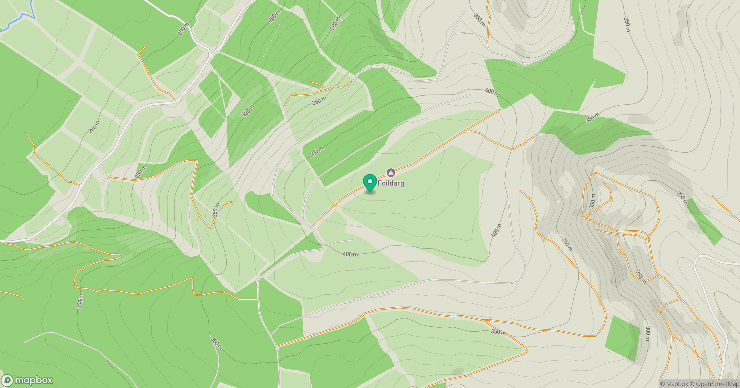
Grid reference: R895511
View on OpenStreetMapOpens a map in a new tab, centred on the hill.
Hills within 30 km
Straight-line distance, not a walking route or confirmation of access.
No comments yet. Be the first.